Mt. Apo National Park
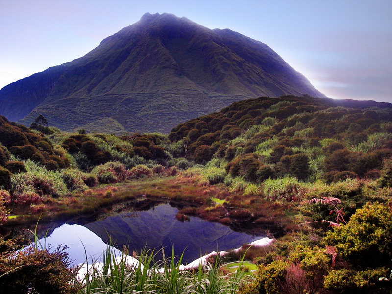
Situated in the island of Mindanao, Mt. Apo, the highest mountain in the Philippines and Southeast Asia's second highest. Known to the natives as kingdom of the mountain god, Apo Sandawa. A vast area of 72,796 hectares of mossy tropical forest, flowing rivers & streams, waterfalls, exotic flora & fauna and is home to the endagered Philippine eagle.
The "Grandfather" of Philippine peaks is the apt name of Mt. Apo which anchors the southern end of a mountain range that bisects Mindanao, the Philippines' southernmost island. Soaring to 2,954 meters (9,691 feet), the highest point in the Philippines, it is the centerpoint of the Mt. Apo National Park straddling the provinces of Davao del Sur and North Cotabato.
At 72,800 hectares, the park is one of the largest in the country and is home to the endangered Philippine Eagle.


Camiguin Island
Camiguin Island, known for its lanzones festival, offers white-sand beaches, spring resorts and magnificent caves untouched by industrial development. The island lies off the north coast of Mindanao. Aside from its beaches, Camiguin boasts of spring resorts and waterfalls.
The 62-square kilometer island-province has more volcanoes per square kilometer than any other island on Earth. Most famous of the island's seven volcanoes is Mt. Hibok-Hibok whose last eruption was recorded in 1951.
Among its popular attractions are the Ardent Spring Resort run by the Philippine Tourism Authority (PTA), the Mt. Hibok-Hibok itself, Santo Niño Cold Spring, Medano Islet, Mantigue Island and the lanzones festival.


Samal Island
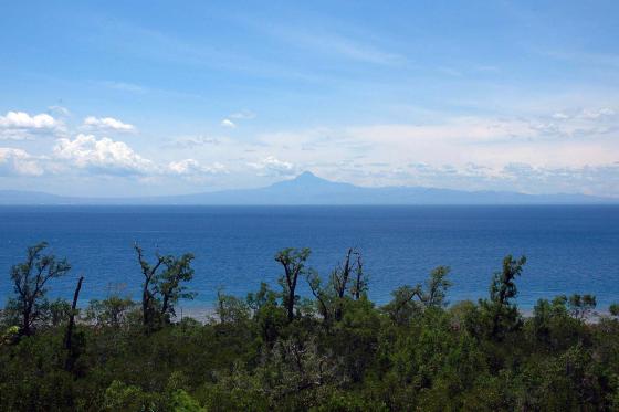
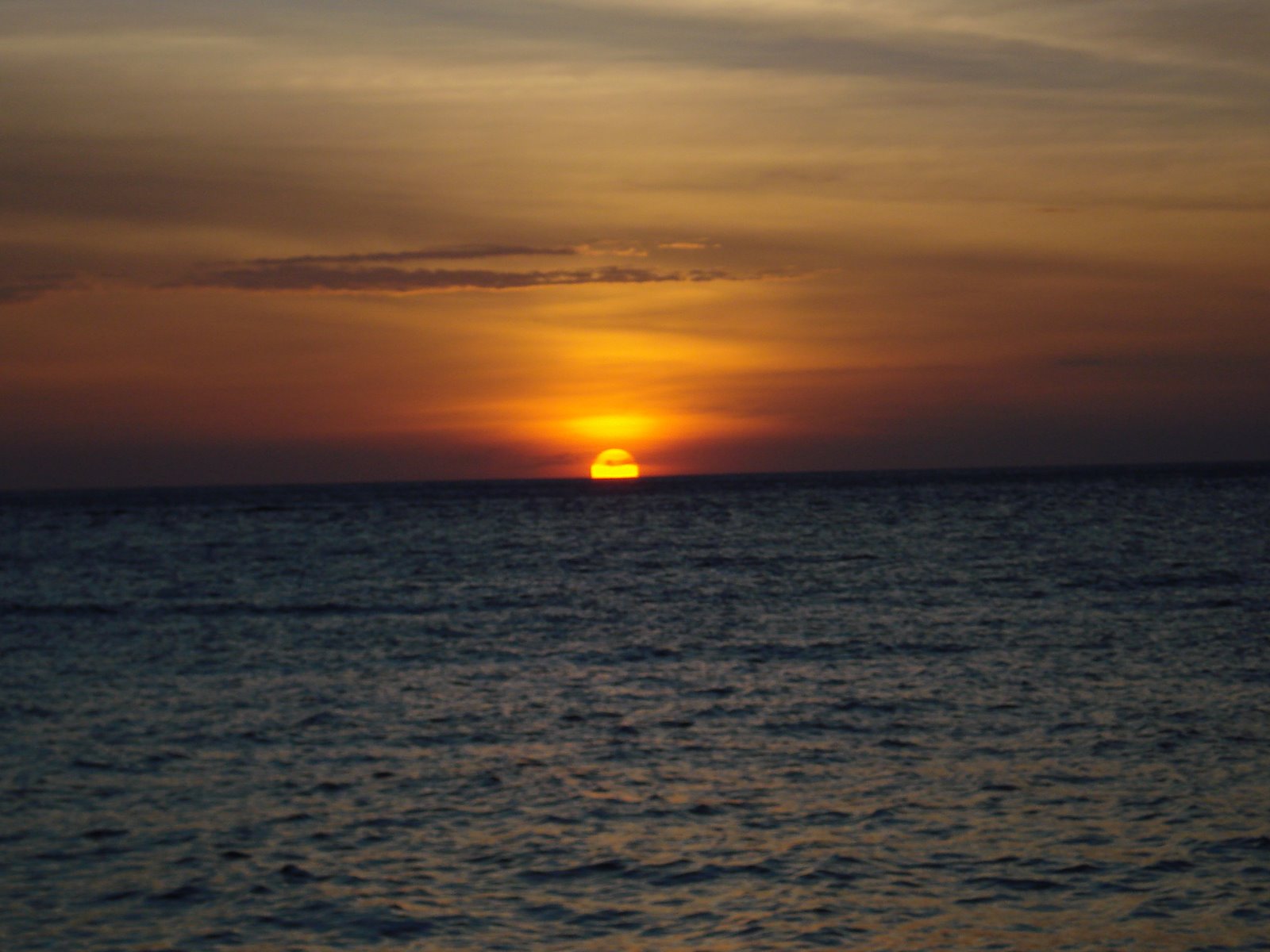
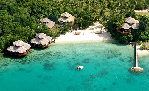
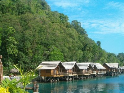
Samal Island offers unending fascination with its white-sand beaches, thick mangroves, coral reefs, rolling hills and rock formations.It is an archipelago of nine islands located in the Davao Gulf about 700 meters south of Davao City. An ideal model for resort and development, Samal Island provides a fabulous site for sunrise and sunset.
Samal Island, like the rest of Mindanao, is outside of the typhoon belt, and enjoys relatively calm weather. Its coastline is characterized by tall, swaying coconut trees, white sand beaches, rock formations, mangroves, coral reefs, and small fishing villages, all suggestive of a tropical island paradise.
Almost all of the beach areas have white sand, with widths varying from only a few meters to more than 10 meters. It provides ample space for picnic huts, reclining chairs for sun bathing, or for simply relaxing and enjoying the tropical scenery.
The water is crystal clear throughout the coastline, which varies in terrain from gently sloping sand beaches to steep cliffs and rock formations. The colors of the coastline at the beach areas transforms itself from the green lush vegetation of coconut trees, to the white sandy beaches, to the dark blue color of the sea, with its deep waters and coral reefs.
Among its popular attractions are the Aguinaldo Pearl Farm, the caves of Talikud Island, the White Stone Mountain, and the San Jose Muslim Fishing Village.


Siargao Island
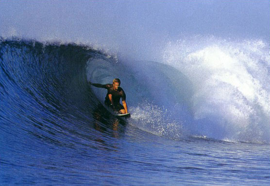
This newly discovered island boasts of white-sand beaches and surfing waves compared to that of Hawaii. Lying 800 kilometers southeast of Manila, the tear-shaped Siargao Island is a perfect haven for the sun, sea, and surf buffs. It lies on the eastern portion of Surigao del Norte and on the southeastern tip of Mindanao. The island is a mass of tropical land with scores of reefs, points and white beaches.
Its promise as a surfing mecca in the making was discovered in 1993 by American surf photographer John Callahan who went to investigate the rumors of spectacular waves in a little known Mindanao town. He came back from his trip armed with stories about the lovely sun-drenched island and documented his find with beautiful photographs.
Siargao opened itself to the international surfing community by playing host to the Siargao Surfing Cup in the municipality of General Luna. Siargao's Cloud Nine break is said to be among the best in the world and foreign sportsmen view "the unparalleled surf of Siargao as a magnet for deep sea fishing, sailing, wind-surfing, kayaking, and sunbathing on miles of white sandy beaches that the reef-ringed island and its rich waters afford the visitor.


The Beaches of Glan, Sarangani
Glan, the largest town in the Sarangani province, boasts of world-class beach resorts and rich fishing grounds. The terrain of Glan is characterized by flatlands, rolling hills and mountains. Most land areas have been converted to agriculture and fishponds.
The town of Glan is bounded on the east by Davao Del Sur, on the north by Malapatan town, on the west by the South China Sea, and on the south by Sarangani Bay.
Many foreign and local tourists flock to the area during summer because of its splendid beach resorts. The sorrounding waters, particularly in Gumasa, Baliton and Margus areas are rich fishing grounds. As many as 2,400 species of marine animals have been found in the bay. The dominant catch include yellow-fin tuna, shipjack, and mackerel.
Glan can be reached from Manila and Cebu by airplane going to General Santos City and a 45-minute drive from the airport.